The Unique Maps Co.
Old Ordnance Survey Map, Sheet 139 - Sidmouth & Bridport, 1925: Seaton, Honiton, Lyme Regis, Axminster, East Devon AONB
Old Ordnance Survey Map, Sheet 139 - Sidmouth & Bridport, 1925: Seaton, Honiton, Lyme Regis, Axminster, East Devon AONB
Couldn't load pickup availability
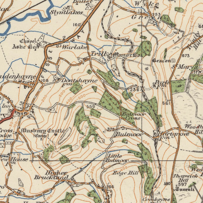
This vintage map, titled "Sheet 139 - Sidmouth & Bridport," is an authentic piece from the Ordnance Survey's One-inch "Popular" edition of England and Wales, published in 1925. The map showcases the towns of Sidmouth and Bridport, as well as several other notable settlements and features in the surrounding area. With its detailed cartography and historical significance, this map is a fascinating piece of history that would make a captivating addition to any wall.
Why choose this map? Here are a few reasons why it is worth displaying:
-
Historical Charm: The map offers a glimpse into the past, allowing you to explore the region as it appeared nearly a century ago. It provides a unique perspective on the landscape, showcasing the towns, villages, and natural features that were present at the time.
-
Missing Modern Cities: While modern cities may not be represented on this map, their absence adds to its allure. It highlights the growth and development that has occurred over the years, making it an intriguing conversation starter.
-
Earlier Place Names: The map may reveal some locations under earlier names, offering a fascinating insight into the region's history. It allows you to discover how places were referred to in the past and how they have evolved over time.
Sidmouth & Bridport, featured prominently on this map, are located in the historic county of Devon. Here are the major settlements and features shown on this map:
- Seaton: A charming coastal town known for its beautiful beach and the nearby Seaton Jurassic, an interactive museum showcasing the area's rich geological and natural history.
- Honiton: Renowned for its lace-making heritage, Honiton is a market town with a long history dating back to Roman times. It is also home to the Allhallows Museum, which exhibits local artifacts and tells the story of the town.
- Lyme Regis: A picturesque seaside town famous for its fossil-rich cliffs, Lyme Regis is part of the Jurassic Coast World Heritage Site. It offers stunning coastal walks, charming streets, and a fascinating history of fossil discovery.
- Axminster: Known for its historic carpet industry, Axminster is a market town situated on the River Axe. It has a long-standing association with quality carpet manufacturing and is home to the popular Axminster Carpets company.
- East Devon AONB: The East Devon Area of Outstanding Natural Beauty covers a significant portion of the map, showcasing the region's stunning landscapes, including rolling hills, picturesque villages, and the dramatic Jurassic Coast.
Notable boundaries, rivers, canyons, national parks, or natural phenomena close to these settlements or areas include:
- River Axe: Flowing through Axminster, the River Axe is a picturesque waterway that adds to the charm of the town.
- Jurassic Coast: The map encompasses a section of the Jurassic Coast, a UNESCO World Heritage Site known for its exceptional geological importance and stunning coastal scenery.
Two historical events in this region that occurred no more than 20 years before 1925:
- The Battle of Jutland (1916): Although not directly in the region, this naval battle between the British Royal Navy and the Imperial German Navy took place during World War I and had a significant impact on the region's coastal defenses and maritime history.
- The Great War (1914-1918): The First World War, which engulfed Europe and beyond, had a profound impact on the region and its communities. Many young men from the area served in the armed forces, and the war had lasting social and economic consequences.
Immerse yourself in the history and geography of the Sidmouth & Bridport region with this meticulously detailed map, capturing the essence of a bygone era and offering a captivating glimpse into the past.
Please double check the images to make sure that a specific town or place is shown on this map. You can also get in touch and ask us to check the map for you.
This map looks great at all sizes: 12x16in (30.5x41cm), 18x24in (45.5x61cm), 16x20in (40.5x51cm), 24x36in (61x91.5cm), 30x40in (76x101.5cm), 37x50in (94x127cm), 45x60in (114x152.5cm) and 52x70in (132x178cm), but it looks even better when printed large.
I can create beautiful, large prints of this map up to 90in (229cm). Please get in touch if you're looking for larger, customised or different framing options.
The model in the listing images is holding the 18x24in (45.5x61cm) version of this map.
The fifth listing image shows an example of my map personalisation service.
The labels on this map are very small at 12x16in (30.5x41cm). The map is still very attractive, but you may struggle to read the smallest letters. Please buy a larger map if it's important to be able to read the map easily.
If you’re looking for something slightly different, check out my main collection of UK and Ireland maps.
Please contact me to check if a certain location, landmark or feature is shown on this map.
This would make a wonderful birthday, Christmas, Father's Day, work leaving, anniversary or housewarming gift for someone from the areas covered by this map.
This map is available as a giclée print on acid free archival matte paper, or you can buy it framed. The frame is a nice, simple black frame that suits most aesthetics. Please get in touch if you'd like a different frame colour or material. My frames are glazed with super-clear museum-grade acrylic (perspex/acrylite), which is significantly less reflective than glass, safer, and will always arrive in perfect condition.
Share