The Unique Maps Co.
Old Ordnance Survey Map, Sheet 113 - Reading & Newbury, 1925: Wokingham, Basingstoke, Fleet, Kingsclere, Tadley
Old Ordnance Survey Map, Sheet 113 - Reading & Newbury, 1925: Wokingham, Basingstoke, Fleet, Kingsclere, Tadley
Couldn't load pickup availability
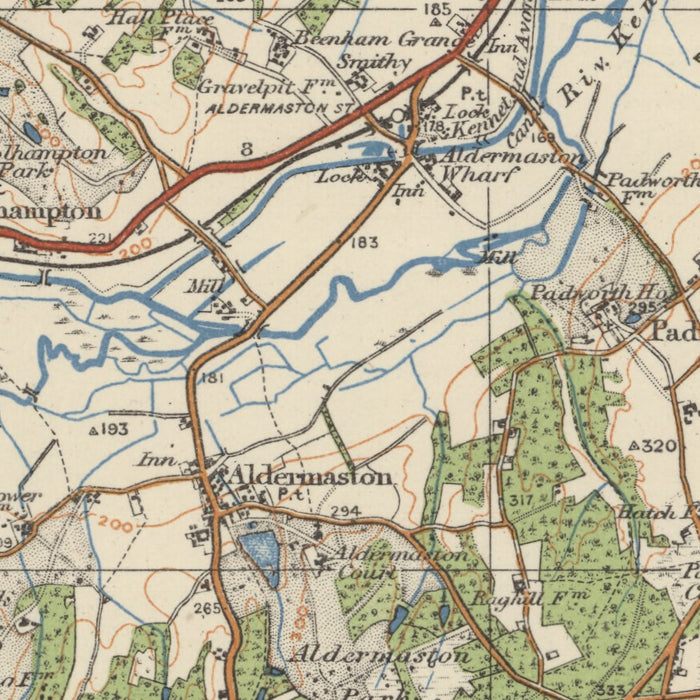
This vintage map titled "Sheet 113 - Reading & Newbury" from Ordnance Survey's One-inch "Popular" edition, England and Wales, published in 1925, is a fascinating piece of cartographic history. The map showcases the towns of Reading and Newbury, along with several other significant settlements and features in the surrounding area. In addition to its historical value, this map offers a unique glimpse into the past, allowing you to explore the region as it appeared almost a century ago.
Featuring the towns of Wokingham, Basingstoke, Fleet, Kingsclere, and Tadley, this map provides a comprehensive overview of the region's urban centers during the early 20th century. It is worth noting that while some modern cities may not be present on this map, it is exciting to discover that certain locations are depicted under earlier names, adding an extra layer of historical intrigue. Reading and Newbury, both located in the historic county of Berkshire, are the focal points of this map, offering a deeper understanding of their geographical context within the region.
Major Settlements and Features:
- Reading: The historic county town of Berkshire, known for its rich history and cultural heritage.
- Newbury: A market town in Berkshire, famous for its racecourse and historic landmarks.
- Wokingham: A historic market town in Berkshire, known for its charming architecture and proximity to Windsor Great Park.
- Basingstoke: A large town in Hampshire, historically significant for its role as a market town and transportation hub.
- Fleet: A town in Hampshire, surrounded by beautiful countryside and home to Fleet Pond, the largest freshwater lake in Hampshire.
- Kingsclere: A village in Hampshire, renowned for its picturesque setting and connections to the famous Watership Down novel.
- Tadley: A village in Hampshire, known for its rural character and proximity to the beautiful North Wessex Downs.
Notable Boundaries, Rivers, and Natural Features:
- River Thames: The iconic River Thames flows through Reading, offering a vital transportation route and scenic beauty.
- North Wessex Downs: Located near Tadley, this Area of Outstanding Natural Beauty boasts rolling hills, ancient woodlands, and charming villages.
- Silchester Roman City Walls and Amphitheatre: Situated close to Basingstoke, these well-preserved Roman remains provide insights into the region's ancient history.
Historical Events (within 20 years before 1925):
- The Battle of the Somme (1916): This significant World War I battle, in which many British soldiers participated, took place just a few years prior to the publication of this map.
- The Easter Rising (1916): A pivotal event in Irish history, the Easter Rising marked a rebellion against British rule and had far-reaching political consequences.
Immerse yourself in the past with this captivating vintage map, which not only serves as a decorative piece but also offers a tangible connection to the history and geography of Reading, Newbury, and their surrounding areas.
Please double check the images to make sure that a specific town or place is shown on this map. You can also get in touch and ask us to check the map for you.
This map looks great at all sizes: 12x16in (30.5x41cm), 18x24in (45.5x61cm), 16x20in (40.5x51cm), 24x36in (61x91.5cm), 30x40in (76x101.5cm), 37x50in (94x127cm), 45x60in (114x152.5cm) and 52x70in (132x178cm), but it looks even better when printed large.
I can create beautiful, large prints of this map up to 90in (229cm). Please get in touch if you're looking for larger, customised or different framing options.
The model in the listing images is holding the 18x24in (45.5x61cm) version of this map.
The fifth listing image shows an example of my map personalisation service.
The labels on this map are very small at 12x16in (30.5x41cm). The map is still very attractive, but you may struggle to read the smallest letters. Please buy a larger map if it's important to be able to read the map easily.
If you’re looking for something slightly different, check out my main collection of UK and Ireland maps.
Please contact me to check if a certain location, landmark or feature is shown on this map.
This would make a wonderful birthday, Christmas, Father's Day, work leaving, anniversary or housewarming gift for someone from the areas covered by this map.
This map is available as a giclée print on acid free archival matte paper, or you can buy it framed. The frame is a nice, simple black frame that suits most aesthetics. Please get in touch if you'd like a different frame colour or material. My frames are glazed with super-clear museum-grade acrylic (perspex/acrylite), which is significantly less reflective than glass, safer, and will always arrive in perfect condition.
Share